Taking the Cape Horn Exit From the Coast Highway
Story by John Vonderlin
Email John ([email protected])
Hi Russell,
I’m having a few second thoughts about whether Hank Bradley‘s jeep road was the road that was used to get to and from the bluffs to the beach transit around Cape Horn a hundred years ago.
In a quick aside you are right that there seems to be many “Cape Horns,” just as there are many treacherous stretches of road dubbed “Blood Alley.” Harvey Mowry mentions another one in the Gazos Creek area on Page 70 of his book.
In a quick aside you are right that there seems to be many “Cape Horns,” just as there are many treacherous stretches of road dubbed “Blood Alley.” Harvey Mowry mentions another one in the Gazos Creek area on Page 70 of his book.
“Gazos Canyon had its own “Cape Horn.” In his later journals Irvin Bloom refers to it as a sharp bend along the rough trace upstream from the Glenwood Mill and below McKinley’s old mill site. Apparently a troublesome spot, especially in wet weather when unstable earth gave way to slides damming the creek…”
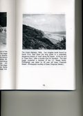
I’ve attached a scan of a photo on Page 75 of Mr. Mowry’s book
that is captioned, “The Coast Highway, 1900. Two buggies southbound for Santa Cruz, start down the long grade to a potentially dangerous stretch of “road” along the beach. At the far end is “Cape Horn,” often a trouble spot for travelers”
Unfortunately you can’t see the road past the buggy because it disappears around the corner, and the resolution of the photo is too poor to show tracks on the beach or a road cut in the cliffs further south. You can see a stream flowing into the ocean. I believe that’s Elliot Creek. Picture #6392 on California Coastal Records Project (CCRP) shows the relative position of the jeep road and the creek.
None of these things are inconsistent with the jeep road being one of the transit stretch’s access/exit point. However, when I was examining the 1972 photos I discovered a road further south starting at Highway 1 and angling towards the beach before it ends at a house by a large gully. That’s photo # 7219051 By the 2005 picture, # 200506707 there is no sign of the house or road. Today even the gully is gone with a large square concrete culvert delivering the water to the beach. Which is why even though I’ve walked nearby many times I’ve not noticed any of this. I hope to change that tomorrow with a little blufftop bushwhacking. Do you know anything about this?
I think it is just south of the southern boundary of Coastways Ranch, based on the position of a sign they put up on the reef, way below the mean high tide line, claiming permission was needed to walk along the beach. I had a confrontation ending in mutual disagreement with the driver of the jeep patrolling the beach one time about my rights and the illegality of the sign. Eventually somebody, not me, must have complained because the sign was removed.
The reason I’m having some second thoughts about the jeep road is I assume the transiters would want to get off the beach as soon as possible, and as you can see in the picture # 7219051 the bluffs begin moving further away from the beach at this spot and are more stable based on their vegetative covering. Because during the construction of Highway 1 they dumped spoils down the oceanside of the road it, is possible that the rest of the old road was covered up. I’ll ask Harvey Mowry in a letter what he remembers.
As to the viability of moving heavy loads over the sand, it was certainly possible. I believe the wave swept nature of the beach here, just as between the mainland and Ano Nuevo Island is key to providing a stable enough surface to cross. In Harvey Mowry’s book he writes, “Some sawmill equipment destined for use at Gazos could have arrived by ship at Pigeon Point. However the majority, bought used from sawmills in Santa Cruz, or new in San Francisco, Oakland or beyond, had to be freighted by horse team and wagon from Santa Cruz.”
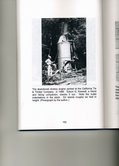
The most interesting account of such freighting in the book was from Mr. Irvin Bloom’s journal when he describes moving a donkey, a steam-powered, self-propelled, skid-mounted winching unit
in 1907 from the Little Basin Mill to a rail car in Boulder Creek. From there it went by rail to Santa Cruz. Next morning Bloom met the company wagons in Santa Cruz where they: “Loaded the teams (wagons) and started them for Davenport at 3 o’clock (P.M.)” “Two days later both wagons were at the Gazos Mill.” It had taken 5 days to to move the donkey 45 miles.
There is another passage describing the “Cape Horn” section where Bloom writes, “Drivers often had to urge their reluctant teams up, over the short rough stretch, and down the far side onto a sandy beach. It could be a difficult traverse for a heavily laden wagon.”
I suspect patience, determination and necessity allowed them to do what we now consider nearly impossible. When I consider whole families crossing the country in Conestoga Wagons, through hostile territory without roads, juxtaposed against the snit I experience when the TSA (Transportation Security Admin) workers ask me to remove my shoes and surrender my tweezers after standing in line for an hour, I can’t experience anything but respect and amazement for these formidable pioneers.. Enjoy. John.


