Ocean Shore Route
Story/Photos by John Vonderlin
Email John ([email protected])
Hi June,
Ever since I ran into that article in the Newspaper Archive about the 16,000 pounds of explosives being set off north of San Gregorio to aid in the creation of the Ocean Shore Railroad’s route, I’ve been thinking more and more about the railroad’s proposed route. I haven’t yet tried to find the 65,000 cubic yard displacement that the mighty blast caused, but I did run into an interesting document that is related: It concerns the railroad’s projected route, at least at some point in time, across Pescadero Creek.
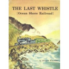
I had theorized about this part of the railroad’s route in a posting concerning the tunnel (quite possibly originally built to store explosives) that used to exist in the side of the hill just above the northernmost parking lot of Pescadero State Beach Park. Based on the length of the planned trestle for Pescadero Creek which I found in a document in Jack Wagner’s out-of-print book, “The Last Whistle,”  as well as the knowledge that Highway 1 now follows much of the railroad’s planned route, I assumed the Ocean Shore would have taken a straight shot down the hill, across the dunes, and over the creek bed to the solidity of the promontory to the south.
 as well as the knowledge that Highway 1 now follows much of the railroad’s planned route, I assumed the Ocean Shore would have taken a straight shot down the hill, across the dunes, and over the creek bed to the solidity of the promontory to the south.
My theory was bolstered by examining the 1972 photos on the California Coastal Records Project website (CCRP). They show the dune-covered peninsula “the gunbarrel-straight route” would have followed, significantly wider even as recent as then, thanks to the much more generous amount of sand that existed to the west. Straight as a rail is almost always best in the transportation business world.
Well, it looks like I might be wrong. It’s not a certainty, as the “dotted line”
routes of railroad-building dreamers were very flexible even before they met the realities of construction. But, based on the aforementioned 1960’s document, it would seem the railroad’s late 19th/early 20th century planners tried to avoid as much of the sandy stretch as possible by bowing to the east, following the lower contour of the hill and then a promontory jutting out from it, until returning to the dune area, where a raised trestle started and continued until it had crossed the creek. I’m guessing with well-driven pilings, the problem of blowing sand drifting on the rail-bed, as well as flooding from the creek, either during storms or when a sandbar across the creek’s mouth created a large lagoon, all would have been dealt with nicely.
I’ve attached a shot of the railroad’s document showing the bow in the line with

added black boxes to help see the route. I’ve also attached a Screengrab from a recent CCRP picture (Picture #200809967) that focuses on the area at the point

the route returns to the dunes, crossing over one short swampy stretch.
One of these days I’ll try hiking around “North Pond,” as the area encompassed by the route’s bow is called, to see if there are any signs of the railroad’s rail-bed left, other then the faint ledge, that up to now I had thought was only big enough for a jeep or possibly a long ago stage road.
My last visit there was the nearly disastrous, and ultimately unsuccessful attempt, I made to attempt to remove two car tires that had irritatingly been scarring the limited beauty of the North Pond’s mudflats for more then a year. This time I’ll try to verify whether this “new” route was ever graded and hopefully not start the New Year as a stick-in-the-mud theorist. Enjoy. John
