Who is Monty Parker?
 Story & Photos by John Vonderlin
Email John ([email protected])
Hi June,
We thought if we could get to the cliff edge above the cove during the next try to reach “The Notch,” Meg could lower the camera down to me when I reach there by swimming and pull it back up after I’d documented this extremely difficult -to- reach- stretch of the coast. With two free hands, swimming the turbulent route out through the Acid Beach Arch, then north along the rocky, wave-battered cliff to the cove would be a lot safer for me too.
I thought there might be artifacts covered by the thick underbrush that could help us discover who this man of mystery was.
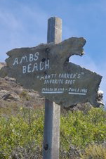
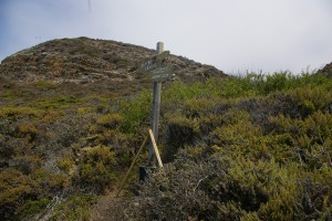
Lo! and Behold! Somebody still likes Monty, whoever he is. The sign is now held upright in a concrete-filled 15 gallon black bucket, steadied by sticks. Unlike whoever carried a hundred pounds of concrete to the site, I was too lazy to climb the steep hill to get a pen and paper, but next trip I’ll leave a note in a bottle asking Monty’s mysterious admirer to contact me, even if anonymously.
While looking for clues about “Monty Parker’s favorite place in the world,” as the sign says, I also checked the California Coastal Records Project CCRP website’s archived pictures of this area through the years. I was surprised to see how busy this place was decades ago. In the 1972 picture (#7219067) there was a big parking lot beside Highway 1, and no less then four good-sized paths, leading down to the “Rappel Spot,” where people would lower themselves down the cliff to the beach. The 1979, 1987, 2002, 2004, and 2005 photos progressively show less and less evidence that people visit here.
A berm built along Highway 1, sometime in the last few years, essentially keeping cars off the bluff, has accelerated this process since the 2005 photo.
It was the 2005 photo (#200506752), with its caption about the Merry Pranksters Rappel Spot and LSD, that led me to explore this area initially. Without that “X Marks the Spot” clue, I don’t think I would have been drawn to this area. But now that I’ve explored it somewhat, I wish the cliffs could tell me their stories about the Pranksters, Monty Parker and the other characters who were drawn to this isolated, dangerous, and stunningly beautiful stretch of our coast. The truth is out there and I want to find it.
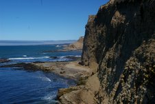
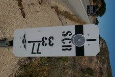
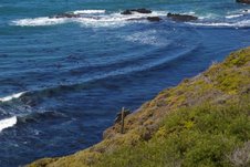
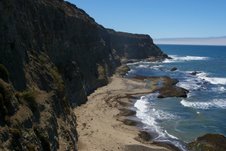
I’ve attached photos of the road sign just across Highway 1 from the gulch that the Rappel Spot and Monty’s sign are at the bottom of. I’ve also attached photos of the recent sign construction and the north and south coastal views Monty’s spirit resides over. It would be hard to find a more eternally pleasing view spot in this world.
P.S. The southern view shows the easy last part of “The Gauntlet,” as Larry Fitterer dubbed it, with Chicken’s Roost being the rock projecting into the ocean at the point where the coast disappears in the photo. The northern view includes part of Warm Water Lagoon in the center and Greyhound Rock and Ano Nuevo Island in the background..
