Part 4
 Story & Photos by John Vonderlin
Email John ([email protected])
Hi June,
Before venturing out to photograph Lake Lucerne, and the remnants of the Bean Hollow Bridge, I checked them out on the California Coastal Records Project website. Picture 6283 shows the area very well. You can see the beach, the creek’s outlet onto the beach, Highway 1, the marsh the bridge used to span, Bean Hollow Rd, and Lake Lucerne in the background.
By doubleclicking on the photo you can access the large photo file and see, if just barely, some of the remnants of the old bridge’s pilings in the marsh. Unfortunately, when you hit the “Time Comparison” button and get access to the photos from 1972, 79 and 87, they are of insufficient resolution to follow the decay of the pilings through the last few decades. Still, the aerial photos gave me a good idea where the historic photo had been shot from. My plan was to reshoot it from that same angle, hoping to show the changes wrought on the area by more then a century’s passing. It turned out to be not so easy.
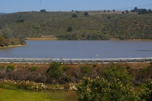
Our first stop was along Bean Hollow Rd, at a pulloff by the spillway. Nowadays, Coburn’s dam has been replaced by the rampart that the road sits on. The rampart has been clad with a concrete-facing on the lake’s side as this picture shows.
The floodgates are gone and the spillway is nothing more then a small bridge over Frijoles Creek’s concretized exit towards the sea.
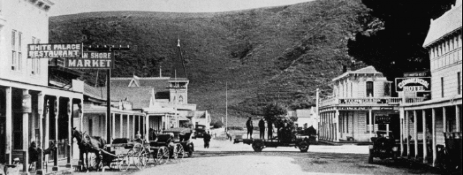
Looking across the marsh towards Highway 1, you can see the remnants of three rows of pilings, just as the historic photo shows the bridge had.
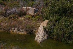
If you care to stomp through the pickleweed and other marsh plants you can see the northern concrete footings of the old bridge.
I must say it amazes me that the stumps of the piers still exist after considerably more then a hundred years of sitting in the water or mud of the marsh. I wonder what kind of preservative they must have been soaked in. Undoubtedly not anything the E.P.A. approves of these day. Some have been eroded into attractive stumps.
From there it was time to see if I could get that shot from above Highway 1 from the same place the historic photo was shot. The bane of so many of my exploratory trips, poison oak, thwarted me repeatedly. It was everywhere on top of the hill west of the highway where I judged the shot had been taken from. By sneaking under a large pine tree I got to what I judged to be the right height, but the tree blocked my view and the poison oak kept me from moving into the clear. Giving up, I walked along the east side of the Highway I and got a few nice shots of the pilings from the south.
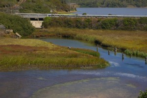
Heading north I got this one, probably the closest to the old bridge shot.
That’s a Great Gray Heron, we spooked, in the middle of the photo.
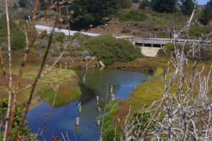
Finally, not wanting to give up, I lined myself up with the pilings and risked bushwacking downhill from Highway 1, to where I could get a clear shot of them from above. Fortunately, the poison oak was only scattered through the bushes at this point and by holding my hands above my head and letting my boots stomp things down to make a path, I was able to move into position to get this shot of the pilings (#035
)and this picture of Loren’s legacy, Lake Lucerne.
Happy with my moral victory, we immediately headed to the beach for a good wet sand scrub of any possibly-toxin-exposed skin area. I’m even happier to report this quick action prevented any unpleasant itchy aftereffects. The saltwater’s stinging in the handful of scratches I’d gotten seemed a small price to pay for an interesting view of another bit of forgotten history of this wonderful coast. I suspect the grumpy curmudgeon, Loren Coburn, would have had some solace that at least the picturesque Lake Lucerne remains as a memorial to his unfulfilled dreams, and probably would have chortled at the fact that with P.O.S.T. now owning most of the land around the lake, it is still off limits to the people of Pescadero. Enjoy. John
