Bootleggers Cove Found….

Hi John,

I found the location of Bootleggers Cove from my brother who remembers going there as a kid. It is located south of Franklin Point, not north as I thought.

The cove is on the left side of 7219014 on the California
Coastal Records Project (CCRP)
..

The more current photos may be at high tide since you don’t see the beach. You can see where there could have been a cave at one time.

Linda Iacono

Posted in Uncategorized | Comments Off on Bootleggers Cove Found….

Linda (Wyatt) Iacono & John Vonderlin…Remembering Bootleggers Cove, Russell Towle & Gazos Creek Gas Station

I came across June Morrall’s website Pescadero Memories and read the entire backlog of posts in 2 days. I spent part of my childhood growing up in Pescadero and my dad who just turned 80 grew up there. After I told him about the website we got into a pretty interesting discussion about his memories of the people and places he grew up with. Turns out he even knew Russel Towle from the days that he ran the gas station there at the entrance to Gazos Creek Road when Russel would come in now and again.

The reason I’m emailing you is because of a section of beach he remembers playing on between Franklin Point and Gazos Creek beach. It was called Bootleggers Cove and there used to be a cave that he played in. Apparently it was used by someone he remembers as Benzanni. He’s not sure if that was his real name of not but said he they all thought he was crazy. I don’t know if you have heard of this place in all your explorations and thought you might be interested.

Looking forward to reading more of you posts on June’s website,

Linda (Wyatt) Iacono

———

Hi Linda,

Nice to hear from you. I’m familiar with the stretch of beach you mentioned, from Gazos to Franklin Point, having visited there again just a few weeks ago, but not the name of Smuggler’s Cove. Though that moniker has been attributed to several coves along this stretch of coast, I can see why this would have been a natural spot for such activities. There is sand, lots of it, on a gently sloping beach and few offshore rocks. Plus the highway moves away from the beach as you head south from Gazos, with a old vegetated dunefield filling the ever-widening gap as you approach Franklin Point. The dune field has a series of small parallel valleys that would have been perfect to transport things unseen from the beach to near the road.

The most likely spot for the cave your father mentioned probably is in the small promontory captured in the first picture along with the gulls. The next two photos are shot from that promontory, looking north to the Gazos Creek parking lot and south to Franklin Point. You can see there’s not many places for a cave these days. The last photo is of one of a group of kite surfers who had driven down from Marin to enjoy our great winds on this beach.

If your Dad would like to share any of his other memories, I’d love to hear them. Especially if he can shed any light on some of the subjects of previous postings. If you can show him Pictures #6337 to #6344 (Gazos Creek to Franklin Point) on the “California Coastal Records Project” (CCRP) website, maybe he can pinpoint the location of the cave and cove. Enjoy. John

P.S. I think I remember reading an old newspaper article that said the beach north of Franklin Point was known as “The Fist,” possibly because of a large driftwood tree put in the ground upside down by the trail to the beach.

Email John ([email protected])
————-

Hi John,

I just got back from a trip to Santa Cruz
and took a little tour of the places I lived in the Pescadero area.
Unfortunately all four of the houses (we moved a lot) are gone now but I
still have great memories of all of them.

My dad grew up at the White House Ranch which was right near the
entrance to Costanoa Lodge. I lived there as well in a different house
that they called the White House. It was the old Isaac Graham house
that had been built somewhere out closer to the ocean and moved to where
I knew it to be. Here is a link, please click here
to information about the house. It is also mentioned in the book
Portraits of Pescadero by Tess Black. Both the house I lived in and the
house my dad grew up in burned down years ago. The only evidence I
could find of anything ever being there was a section of pipe sticking
out of the ground.

I will try to find out the exact location of the cave next time I see my
dad.

Thanks for responding,
Linda

Posted in Gazos Creek, John Vonderlin, Linda Wyatt Iacono | Comments Off on Linda (Wyatt) Iacono & John Vonderlin…Remembering Bootleggers Cove, Russell Towle & Gazos Creek Gas Station

John Vonderlin On “The Hole in the Wall”

Email John ([email protected])
Hi June,
Here’s an update about one of the “Holes in Pescadero.”  Some time ago I posted a story called, “The Hole in the Wall.” That’s the hole in the rocky promontory that bounds Pescadero Creek, at the point it enters the ocean. I had originally thought it was “Pescadero’s Pride and Joy,”  the most viewed Sea Arch on the coast. Then a friend told me, while looking at a picture of it on the California Coastal Records Project  (CCRP) site, that he and his partying buddies had called it  the “Hole in the Wall Beach,” back  in the Seventies. And that it had been more obviously hand dug at that time.
Later, in a transcript from a Pescadero Oral History Project, several oldtimers made the same assertion. Giving up on it being a genuine Sea Arch, I  was still dubious that somebody thought it was a good idea to dig a hole through a cliff, hoping thereby to control the timing of the opening of the lagoon. In the attached picture ( Hole in the Wall) from the newly posted  2008 pictures from the CCRP website, (just shot in October)
the futility of man’s effort is poignantly captured. As you can see, the small finger of the lagoon patiently waits for Mother Nature to accomplish things in her own way, just on the other side of the sand-choked tunnel. (marked by bars)
Here’is a photo of the Pescadero Creek bridge from inside the tunnel, shot when it is open,
as it is for a good part of the year. Its manmade nature isn’t real obvious after years of crashing surf. However, earlier this year, while visiting Four Mile Beach, in Santa Cruz County, I photographed this obviously manmade, rectangular hole, in a promontory at the opening of  the creek.
This is the hole, both looking from the oceanside and the lagoonside. By looking at Picture # 6415 on CCRP you can see that this hole was also an attempt to relieve the lagoon behind it. I’ve attached a screen grab of the large file in which I’ve marked the location of the hole with a black bar.
That’s a surfboard leaning against the cliff next to it. If this technique was used in at least two different watersheds, it must have had some success or the word would have spread. Nobody likes to be laughed at, and especially about something that would take so much work to dig and would last for decades as a reminder of your folly.
As I investigate the early history of the Pescadero Marsh, I hope I can answer the question of its utility, along with a few others. But, first I wanted to post about how researching “The Stage Hole,” led me to find out about the largest hole that never was in Pescadero. That’s Part 2 of “Holes in Pescadero.” Enjoy. John
Posted in Hole in the Wall, John Vonderlin | Comments Off on John Vonderlin On “The Hole in the Wall”

100 years ago: Horace Templeton had a strong link to Pigeon Point

Story by June Morrall

[Note: If you’ve been following “The Coburn Mystery” you may see less obvious links to the Pescadero story.]

It was widely known that San Mateo County Judge Horace Templeton stuck to a friend like a brother. It was also known that “Old Temp,” as he liked to be addressed, “hated his enemies with a hatred good and genuine, a hatred that bristled all over with a prick.”

“When I’m off the bench, you can call me ‘Temp,'” advised Horace Templeton. “But when I’m on the bench, you’d best call me ‘Judge,’ and friends and foes will get their desserts alike.”

Born in Vermont in 1824, he 29-year-old bachelor traveled to California, where the whirring sound of sawmills, drew him to the thick redwoods near present-day Woodside. The forest was so isolated that deserters from the British navy and the Hudson Bay Company’s whaling ship Nereid found safety there.

Shortly after Tempeton’s arrival, the town was named Searsville in honor of John Sears, who opened and operated a busy hotel in the busy mill town.

On their way to the Port of Redwood City, all the neighboring lumber companies including Mountain Home, Smith, Mastick and Spaulding Mills, hauled their cut timber through Searsville. The route ran past Dr. R. O. Tripp’s store, today the Woodside Store, maintained by the San Mateo County History Museum.

Horace Templeton witnessed Searsville’s boom. Hundreds of mill boys, employed in the surrounding redwood groves, came to Sunday afternoons for horse racing, fighting, and the famous poker games, with the stakes reaching as high as $1, 000 per hand.

Stages and fashionable carriages dashed up to the hitching post of a second hotel operated by August Elkerenkotter, a Prussian by birth. For a moment in the county’s history, tiny Searsville was at the bustling center of the Peninsula’s lumber industry and its related social life.

Some locals said that Horace Templeton arrived at Searsville with money saved in Vermont. Others gossiped that Templeton’s crooked poker skills enabled him to launch his own business, Templeton’s Mill, in the heart of the redwood forest.

San Mateo County historian John G. Edmonds, attesting to Templeton’s poker talent once wrote: “Lumber was not ‘Temp’s’ most lucrative source of income. He loved to play poker  and he was never known to lose a game.”

In time, Templeton became Searsville’s Justice of the Peace. By 1861 Horace Templeton resided in Redwood City, where large majorities of voters elected him to the first of several terms as a county judge.

Close to Valentine’s Day in 1866, Judge Templeton, now 42, married Ellen Crowley. Two years later, the couple had a son, Robert.

Success made ‘Temp’ an acknowledged leader, a prominent target of praise and condemnation. It was said he played “a bold hand in business and always for keeps.”

“Anything but defeat” was Horace Templeton’s motto. This motto was to be severely tested near the Coastside village of Pescadero.

In the early 1870s, Pigeon Point Landing, six miles south of Pescadero, attracted the attention of Templeton and two allies: former supervisor Josiah P. Ames and Charles Goodall, the president of the Pacific Coast Steamship Company.

Ames was the force behind the colorful, bustling wharf at Amesport Landing (Miramar Beach), four miles north of Half Moon Bay. Charles Goodall’s  steamers picked up the local produce.

Most people considered the trio a powerful group representing local interests. Their detractors labeled them an “unscrupulous ring of speculators.”

By this time Judge Templeton’s sawmill interests had expanded to the Gazos Creek area, south of Pescadero. Templeton realized profits would rise if he gained control of Pigeon Point Landing. the only convenient nearby outlet for shipping.

The Pigeon Point Landing had been cleverly designed with a chute and long outstretching booms and tackle by which small boats were loaded just inside the protective rock on which the lighthouse was built. On the bluff above the landing, stood several large storehouses. Portuguese whalers had built cottages and a look-out station there.

Blocking Templeton and his associate’s goals as Loren Coburn, an eccentric, controversial millionaire who had moved from San Francisco to be closer to the 10,000 acres of land he owned in and around Pescadero. As owner of Pigeon Point Landing, Coburn had leased out the property for ten years, but that agreement was about to expire. Coburn’s plan was to take over the operation. He was thwarted when Templeton, Ames and Goodall shrewedly took over the remainder of the lease from Coburn’s renters. They won permission from the Board of Supervisors to build a new wharf and pier there.

This was a risky strategy—-Coburn intended to take over the landing at the end of the lease, grateful for all the improvements.

The lease with Coburn expired, but the men had no intention of honoring the contract and turning the property back to him. When told to vacate Pigeon Point Landing, Templeton and his partners offered to buy the land but Coburn refused to sell. Then they refused to leave. By summer, Coburn tried to evict the men unsuccessfully.

The Pescaderans, who had many reasons to dislike Loren Coburn, one being that he refused to pay the local school tax, sided with the speculators. The villagers were not impressed with this “San Francisco capitalist” who wore old-fashioned black swallow-tail coats, talked too fast and drove his horses recklessly across the countryside.

Using their political connections, Ames and Templeton petitioned the Board of Supervisors for a wharf franchise, proposing to further modernize the facilities in return for 20 years of use. The petition failed, but the county responded favorably by condemning the land and surveying a road which ran to the end of the loading chute. Coburn retaliated by sending his lawyer to the State District Court in San Francisco.

The court reversed the condemnation on the grounds that the lands were not properly identified, and that the road to the wharf was a private road. The only public property, said the court, was the land within high tide.

Despite the ruling, Coburn could not get physical possession of the landing. The sheriff, who accompanied him with the court order, claimed that he was not certain from the document where the property was located.

Into the intricate legal battle walked C.N. Fox, a former county attorney who represented Judge Templeton. Fox appealed to the State Supreme Court on behalf of his client. Complaints, court orders, counter-orders, and injunctions crossed his desk for 12 months.

Most of the wharf extended into the high tide and the calculating, anti-Coburn investors saw that it was to their advantage to separate it from the private land. The men put up a gate across the wharf at the point where it stretched 100 feet into the high tide, thus officially disconnecting the public property, where they conducted their shipping business, from Coburn’s private property. Armed with a navy six-shooter, Alexander “Scotty” Rae was hired by Templeton and his partners to patrol the gate.

Although the lease had expired, and the San Francisco court ruled that Coburn should regain his land, the Templeton group continued their shipping opration.

While visiting Pigeon Point Landing in February of 1873, then 49-year-old Judge Templeton fell down a cliff, struck his head and was seriously injured. Was he pushed by one of Coburn’s men as a warning of the violence to come?

Judge Horace Templeton’s health deteriorated. None of the doctors at his bedside could cure the “violent pain in his head,” and ten days later he died. Templeton was buried at Redwood City’s historic Union Cemetery.

The struggle over control of Pigeon Point continued, with Templeton’s partners continuing to work on the high-tide side of the wharf.

When the State Supreme Court finally awarded Coburn possession of the wharf, Josiah Ames and Charles Goodall still would not vacate. Coburn’s lawyer, San Francisco attorney William Craig, advised his client to take possession of the wharf peacefully. Shunning Craig’s advice, Coburn hired four gunslingers in San Francisco and brought them back to Pigeon Point.

Nearly two years after Templeton’s death, Coburn’s gunslingers took possession of the loading chute, building a breastwork of planks two feet high across the chute. In the early morning hours when Scotty Rae, who shared an office with the telegraph operator, saw the fortifications, he reached for his navy six-shooter. He rushed down the chute, cursing and threatening as he advanced–this despite the number of cocked guns pointed at him.

The gunfighters warned Rae that he had better not set foot on the wharf. The argument grew heated, with Rae impulsively firing at one of the gunfighters, but missing. In the flash of a gun, Scotty Rae was a corpse; five balls were lodged in his body, one through the heart.

When news of Rae’s death reached Pescadero, the sentiment against Coburn was intense.

“Lynch him, lynch him,” was the cry as a mob stormed Pigeon Point.

A few hours after the killing, the county coroner impaneled a jury of Pescaderans for the inquest. After quick deliberation, Coburn and the four gunfighters were charged with murder. At the Redwood City jail, Coburn and his hired guns posted bail.

After two murder trials, the first resulting in a hung jury, Judge Daingerfield dismissed the case for insufficient evidence.

In 1878, five years after Judge Horace Templeton’s death, three years after Rae’s death, and after endless amounts of cash had been poured into litigation. Pigeon Point Landing was finally awarded to Coburn.

Horace Templeton’s influence spanned from Searsville to Pigeon Point Landing. In 1891, after the houses of Searsville were moved, the village vanished as the site was flooded by a man-made lake, today part of the Jasper Ridge Biological Preserve. The wharf at Pigeon Point Landing no longer exists.

…more coming….
Posted in Judge Horace Templeton | Comments Off on 100 years ago: Horace Templeton had a strong link to Pigeon Point

Kite Surfer….a moving picture by John Vonderlin

A Moving Picture by John Vonderlin

Email John ([email protected])

Hi June,
Here’s a little kite surfing Flip video I did that day. The Flip handled shooting directly into the sun pretty well. I should have used the telephoto at some point, but I’m learning. I’m going to start doing more 360 shots of places I visit. I usually do a few photos to remind me where a string of photos are from, but a bit of video tells a much more detailed story.  Enjoy. John
To view, please click here
Posted in Uncategorized | Comments Off on Kite Surfer….a moving picture by John Vonderlin

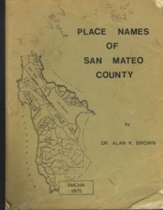
Dr. Alan K. Brown’s “Place Names of San Mateo County”

My well worn copy of Dr. Brown’s book, “Place Names of San Mateo County,” published by and available at the San Mateo County History Museum Bookshop in Redwood City. An invaluable resource for every Coastsider!

Posted in Uncategorized | Comments Off on Dr. Alan K. Brown’s “Place Names of San Mateo County”

Connie Morgan, On a Whim, Discovers an Ancestor..

Dear June,

I just wanted to let you know how great it has been to “discover” my ancestor, Loren Coburn, while reading your book, “The Coburn Mystery.”  I happened to pick up the book while at the San Mateo County Historical Museum in Redwood City last week on a whim, knowing that Coburn is a family name on my mother’s side.  I checked out the stats in my Coburn genealogy book and sure, enough, there it was!

Loren Coburn born in Vermont, living in Pescadero!

This published genealogy book was the treasured book that my grandmother had researched and finally had published during her lifetime.  I have always been interested in family history so, of course, I was loved reading about Loren, Wallace, Loren’s wives and their connections to the many places I have loved to visit while living here on the San Mateo Peninsula.  In fact, today, my husband and I went to Pigeon Point Lighthouse and enjoyed reading the historical information there, which included the famous gunfight.  Then we traveled to Pescadero, of which I have been to many times, and matched your book up to Coburn building sites, etc.  It was a lot of fun.

Thanks again!
Sincerely,
Connie Morgan
——
Hi Connie,
“…I am so glad you are enjoying the book and I am positive that the Pigeon Point lighthouse folks were excited and delighted to meet you.

I have been using an old, original manuscript of the Coburn story in my Pescadero  blog—that means I am detailing the story even more.

In my view, the story of Loren Coburn is a huge part of Pescadero’s history.  It is certainly a unique story.

The Coburn’s home once stood across the street from Duarte’s Tavern in Pescadro. There have been fires but, inn a way, Pescadero hasn’t changed that much!

Please stay in touch.

Best Wishes, June

————-
Hi June,

“… Thanks again for the opportunity to learn more about my ancestors.  I have learned so much over the years.  I have been able to research the Coburn (Colburn) histories while visiting the North Eastern part of the United States several times.  During these visits I have been able to visit old archival records of the families and have been able to locate significant grave sites.

I even saw what was left of the original Edward Coburn Garrison House in Massachusetts (circa 1670’s).   Our line has been traced back to Edward Coburn (Colburn) who came to America from England in 1635 on the ship, “Defence.”  He was 17 at the time.  It’s been quite an education and your book now completes a chapter on the Western side of the United States.

It’s been really interesting, to say the least!  Keep on writing!
Thanks again!
Connie Morgan
Posted in Connie Morgan, Loren Coburn | Comments Off on Connie Morgan, On a Whim, Discovers an Ancestor..

Holes in Pescadero, Part 1: Story by John Vonderlin

Holes In Pescadero, Part1

Story by John Vonderlin

Email John ([email protected])

Holes in Pescadero, Part I
Hi June,
Just as with many of my previous postings, the next two will deal with holes in Pescadero. One hole had a minor historical significance and still exists. The other was never created, and if created would have been filled as fast as possible anyway. Oddly, the longterm utility of the first may have led to the never-realized dream of creating the second one.
The first hole was brought to my attention, once again, by Dr. Alan Brown’s 1960 book, “Place Names in San Mateo County,” [published by, and available at the San Mateo County History Museum in Redwood City.]
While reading through Place Names, I discovered a couple of entries that piqued my interest.

The first was for “The Stage Hole,” and simply said:

“The Stage Hole (The pond at Nunziati’s dam in Pescadero beyond the end of Water Lane). At some distant date a stagecoach upset into the water here (Alec Moore) The wagon and stage road ran past here in the middle and late 1850’s”
That was followed by another entry for “The Stage Road,” that stated in part: “…it has been so called in Pescadero ever since it was built in 1859, by the leading citizens of that place, for the Pescadero-Spanishtown Stage Company.”
I’d only been down Water Lane once, to visit the eastern edge of the Pescadero Marsh Preserve, so it seemed like a return visit was in order. I’d been checking out possible kayaking routes deeper into the Preserve than our forays up Pescadero Creek from the oceanside lagoon had permitted. The highlights of that first trip were the views from the top of Round Hill and the minor mystery of a large circular enclosure made of plywood at its base. Having done some bushwhacking to get to it, we were initially mystified why somebody would build such an expensive fence in the middle of nowhere.
Plywood Fence below Round Hill
One Way Wire Cone
View from Round Hill
View of Round Hill
As we made our way around its perimeter, the small holes cut in the plywood at regular intervals, with wire cones in them, strongly hinted at what we were seeing. But, the full details and purpose of this project were only revealed by an Internet search that brought up this government website:
Round Hill Levee Removal IS/MND. Pescadero State Beach levee near Round Hill separates Pescadero Creek from its floodplain, thus preventing
parks.ca.gov/pages/980/files/6228 draft is-mnd round hill levee removal pescadero
The purpose of the enclosure was to keep San Francisco Garter Snakes or Red-Legged Frogs from entering the enclosed area and allow any in there a one way method of egress, before the levee removal project was attempted. I hope those critters, assuming there were actually any there, appreciate the trouble somebody went to in order to protect them.
But back to my trip to “The Stage Hole,” in Pescadero. Water Lane runs north off of Pescadero Road about a half mile east of  downtown Pescadero. Near its end you’ll pass this sign and deadend at the Ranger Station.
Preserve Sign

Park there and head up the dirt road to the right. With a gentle slope and a hairpin turn it brings you to the top of a hummock behind the Ranger Station. On top of the hummock the road takes a hard right.
.. To your left is “The Stage Hole,”  separated from the canyon that slopes steeply away to the right by the previously-mentioned  road-topped Nunziati earthen dam, over which the stage road must have run.  It is quite possible that on this turn, a hundred and fifty years ago, a stage pulled by a  fresh team of horses, just harnessed up in Pescadero, urged up their first hill by the explosive crack of a whip, overshot, and tumbled into the water. “The Stage Hole,” is dry now, but it must be seasonally full, as there is a healthy clump of cattails covering much of its dry bottom.
The Stage Hole
The Stage Hole
Hiking around a bit, it became obvious that there had been a series of interconnected ponds here at one time, My guess is they provided gravity fed water to some of the crops that were grown in the rich soil of the marsh’s flatlands just to the west.. On the edge and descending into one of the ponds there is a series of stones arranged like steps. Given the pipe rising a few inches from out of the ground  between the large, cemented-in-place boulders at the top of this “stairway,” the  purpose apparently was to prevent erosion as the water was pumped in.
Stone Fountain
Possibly there are the remnants of a hundred and fifty year old windmill somewhere in the marsh below. It would have harvested the frequent Westerlies coming off the ocean to fill  their system. Remnants of power poles indicate an electric pump accomplished the same purpose at a later time. In its time it was a near perfect system to wrestle a decent life out of the natural resources of the coastside.  I think this pleasant little place may have been the inspiration for a proposal to build an extremely large hole elsewhere nearly 40 years ago. But, that’s for Part 2 of ” Holes in Pescadero?” Enjoy. John
P.S. I’ve attached an excerpt from an old U.S.G.S. topo map with a blue square about where I believe “The Stage Hole,” is located. Note the dark lines, denoting old dirt roads, that proceed across Pescadero Creek, heading both for the coast and back towards town. One of these was quite possibly the route northward for the stage until it was changed to the Stage Road  route in 1859. Maybe somebody local knows.
I’ve also attached a part of a California Coastal Records Project picture from 1987 showing the area, with “Round Hill” and “The Stage Hole” marked. You can see the outline of some of the fields that were abandoned by then.
U.S.G.S. Map of area
California Coastal Records Project Map #8713113 (1987)
Posted in Dr. Alan Brown, John Vonderlin, Nunziati Dam | Comments Off on Holes in Pescadero, Part 1: Story by John Vonderlin

Abe Lincoln in Pescadero?.?.?..Story by John Vonderlin

Story by John Vonderlin

Email John ([email protected])

Hi June,

President Abraham Lincoln in Pescadero?
Not quite, but I did find a connection between Honest Abe and Pescadero recently. I was reading Dr. Alan Brown’s  book, “Place Names of San Mateo County,” when I found this entry under the heading of Lincoln Hill:

“Due South of the center of Pescadero.  A year ago or two ago, a gentleman from San Francisco proposed to have a flagstaff on this noble looking mount on condition that it should be named “Lincoln Mount,” all of which was done. The last winter’s storms and winds, however, carried away the staff, but the spot is still cherished and will always bear the memorable name of Abraham Lincoln, of course. (S.F. Alta 3/27/1867)” Dr. Brown then commented,  “The adoption of the more natural present name was doubtless made almost immediately.” Oh, those fickle Pescaderans.

I must confess I’d never heard this name, but I drove through Pescadero yesterday on one of my forays to the coast and took these pictures
of the “noble mount” that presides over Pescadero. I searched around its base in the downtown area and found no obvious trails to its top, but I’ll investigate a little more in the future. Unless my memory is faultier then I think, there are a number of historical photos of downtown Pescadero that were obviously shot from the commanding view the top of this hill must provide.
What was more interesting to me was the source of this little historical tidbit, the “S.F. Alta.” A quick check of Wikipedia brought up this: “In the second half of the nineteenth century, there was a San Francisco-based newspaper called The Daily Alta California (or The Alta Californian). Mark Twain‘s first widely successful book, The Innocents Abroad, was an edited collection of letters written for this publication.”
Using “The Daily Alta California” as a search term I brought up the following Wikipedia entry.
“The Daily Alta California was a San Francisco newspaper descended from the first newspaper published in the city, Samuel Brannan‘s California Star which debuted on January 9, 1847. Brannan, who had earlier assisted in publishing several Mormon newspapers in New York, had brought a small press with him when he immigrated to California as part of a group of Mormon settlers in 1846.
With Dr. E.B. Jones as editor, the California Star was the city’s only newspaper until an older publication, the Monterey Californian, moved to Yerba Buena, as San Francisco was then called, from Monterey in mid-1847, becoming simply The Californian. The city was about to undergo rapid changes as the California gold rush got underway. The California Star appeared weekly until June 14, 1848, when it was forced to shut down because its entire staff had departed for the gold fields. Its rival newspaper had suspended publication for the same reason on May 29.Later that year, Sam Brannan sold his interest in the moribund California Star to Edward Cleveland Kemble, who also acquired The Californian. Kemble resumed publication of the combined papers under the name Star and Californian on November 18, 1848. By 1849, the paper had come under the control of Robert Semple, who changed its name to the Alta California. On January 22, the paper began daily publication, becoming the first daily newspaper in California. On July 4, 1849, Semple began printing the Daily Alta California on a new steam press, the first such press in the west. Other names commonly referring to the paper include the Daily Alta Californian, the Alta California, and the Alta Californian.”
With Abe Lincoln and Mark Twain being a couple of my childhood heroes I’m looking forward to checking out the ongoing nationwide 20 year long online project part of which is detailed below. Perhaps I can find the full article about that “gentleman from San Francisco” and find out why he paid to memorialize Abe in Pescadero. Enjoy. John
Under the NDNP and LSTA grants, the Center has digitized over 150,000 pages of California newspapers spanning the years 1849-1911. They include the Alta California (1849-1889); the San Francisco Call (1900-1910); the Amador Ledger (1900-1911); the Imperial Valley Press (1901-1911); and the Los Angeles Herald (1905-1907).
Posted in Uncategorized | Comments Off on Abe Lincoln in Pescadero?.?.?..Story by John Vonderlin

The Coburn Mystery: Chapter 56

And then San Mateo County Assemblyman and attorney James T. O’Keefe proposed that Pebble Beach become a county park. I’m assuming he was referring to the beach of fancy pebbles, more “valuable” when it wasn’t covered by the incoming tides.

O’Keefe’s constituents in San Mateo were big fans of the resort, he said, and the best thing he could for the voters was to open Pebble Beach as a public park. As another powerful incentive, he pointed to the prosperity that would rain on Pescadero.

The Assemblyman painted a hopeless picture of the situation then, the Coburn “problem,” and all the gory details about the fence (building it up, tearing it down. Again. Again. And Again.) He reminded voters that Loren Coburn owned 3 miles of shoreline, part of the Butano Rancho, from the mouth of Pescadero Creek to Bean Hollow Lagoon.

General store owner J.C. Williamson wrote: “The passage of the bill will forever set to rest any controversy as to the present ownership and right-of-way.”

Most people probably just wanted the beach open so they could enjoy the pebbles.

The “San Mateo Times Gazette” supported Assemblyman O’Keefe’s “Pebble Beach War,” opining that the “most graceful” thing that Loren Coburn could do was to give way to the majority opinion, explaining that the landlord would, in the long run, be “losing little and gaining much more.”

But that was not to be.

Posted in Uncategorized | Comments Off on The Coburn Mystery: Chapter 56